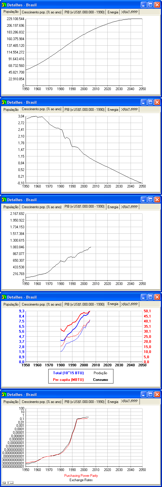
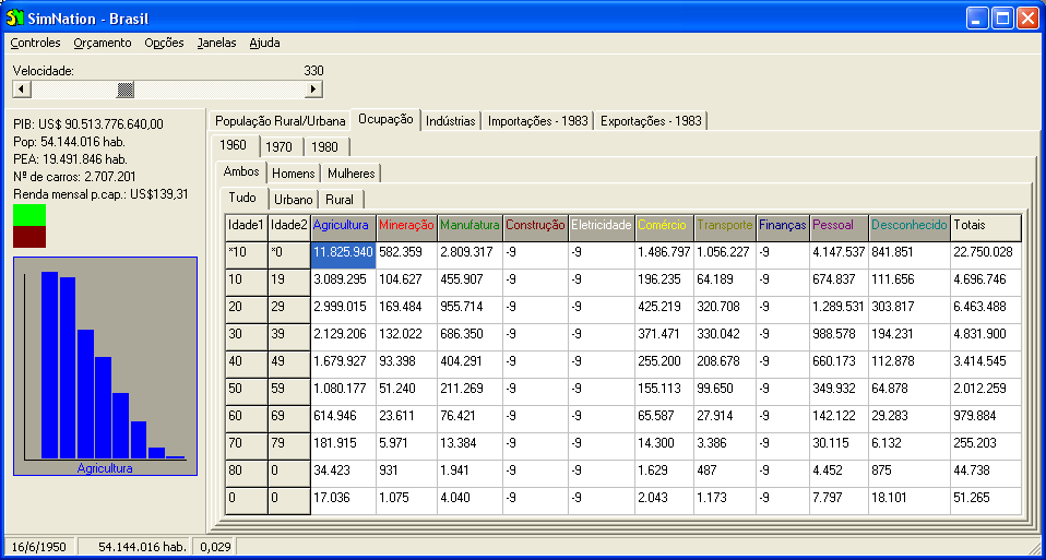
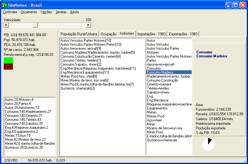
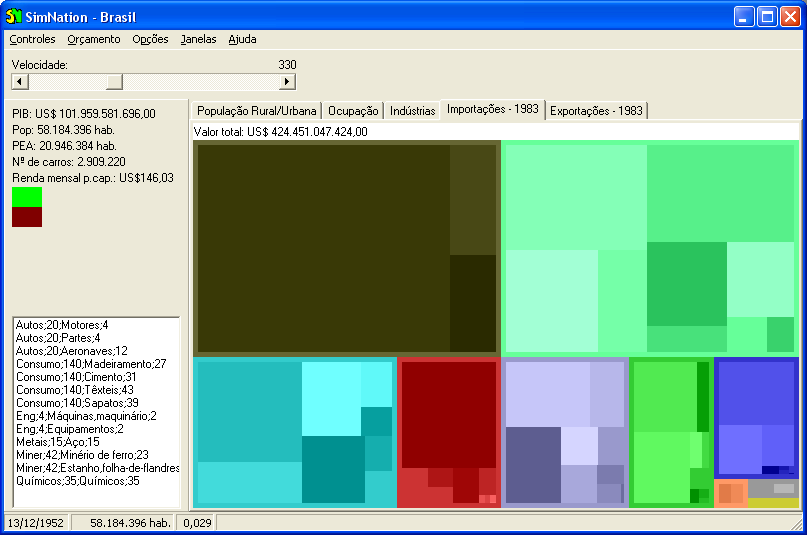
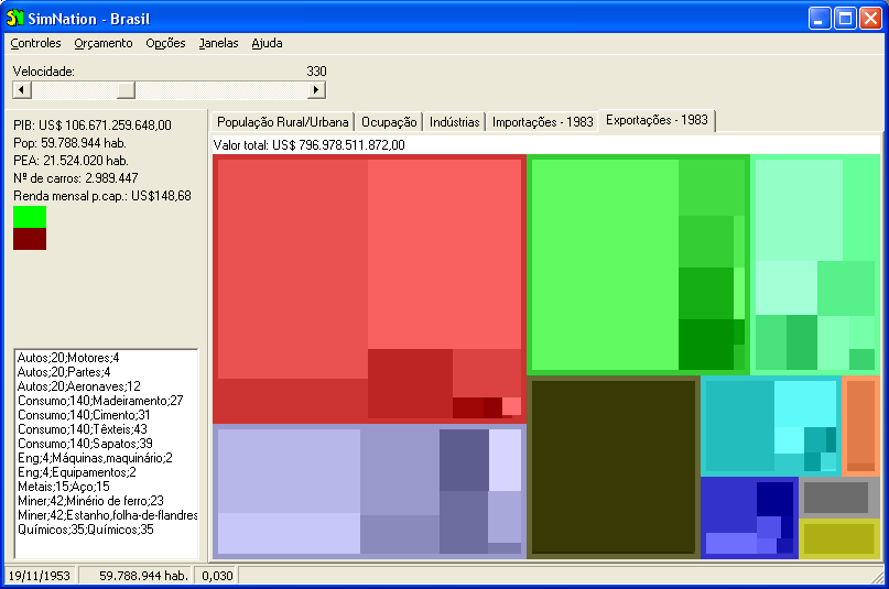
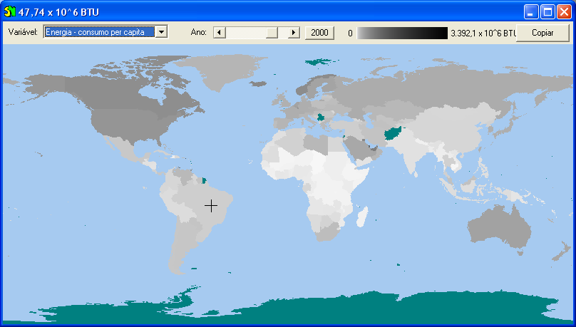
My project is a simulation of real countries, with data about population growth, land use, biodiversity, energy budget, foreign trade, industries, agriculture, ocupation of the working class, and so on.
The main idea is to teach people how things happen in real world, so they won't believe no more in the thousands of lies told by politicians, media and large corporations. I'm very concerned about our common future and the so-called "sustainable development".
The first point is to assemble a visualizer for this kind of data (already done for land use of almost any country; now in the process of inserting roads, administrative boundaries, conservation units, etc). Then different applications can be developed over this base project. Two main applications come to mind:
1) a GIS environment where gaps in the data can be filled by comparisons with similar countries (e.g. if we don't know what a specific african country exported in a given year, we can "extrapolate" data from countries with similar "structure" [demography, vegetation and soil data, dominant religion, local currency, taxes, inflation indices, etc.] and also from the same country in different years). Different scientifical approaches can be tested in such environment;
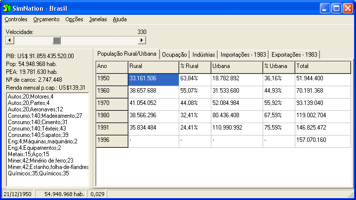
2) a game called SimNation, similar in style to the classical SimCity, but here you'll be the president (or dictator) of the country of your choice. Running from 1950 to (at least) 2050, you'll plan and see the growth of cultivated area, urbanization, infrastructure projects (like dams and roads), and all the impacts they cause, such as GDP growth, erosion, loss of biodiversity, diseases, water pollution, criminality, etc. You can also accept (or not) the creation of conservation units (based initially on real ones) and invest in "green" technologies, education, etc. Wars and political treaties should also be possible. Everything you do will have reflects in the future.
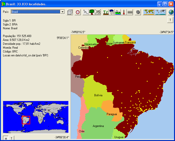
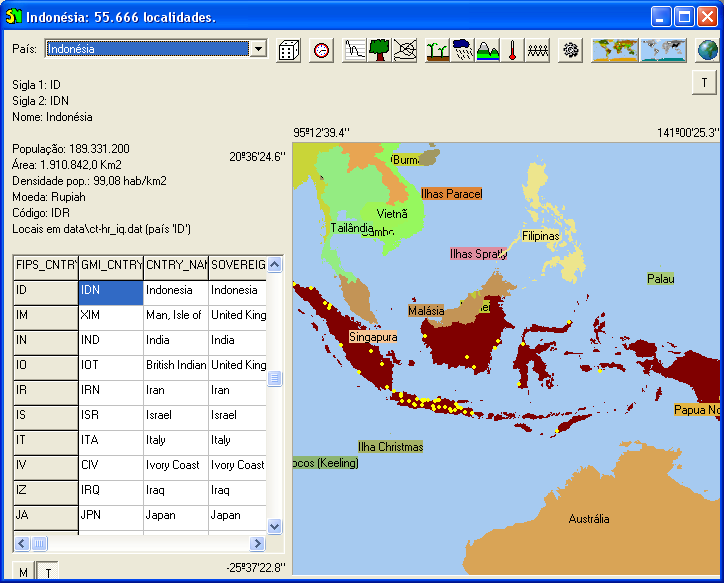
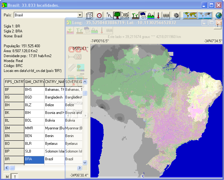
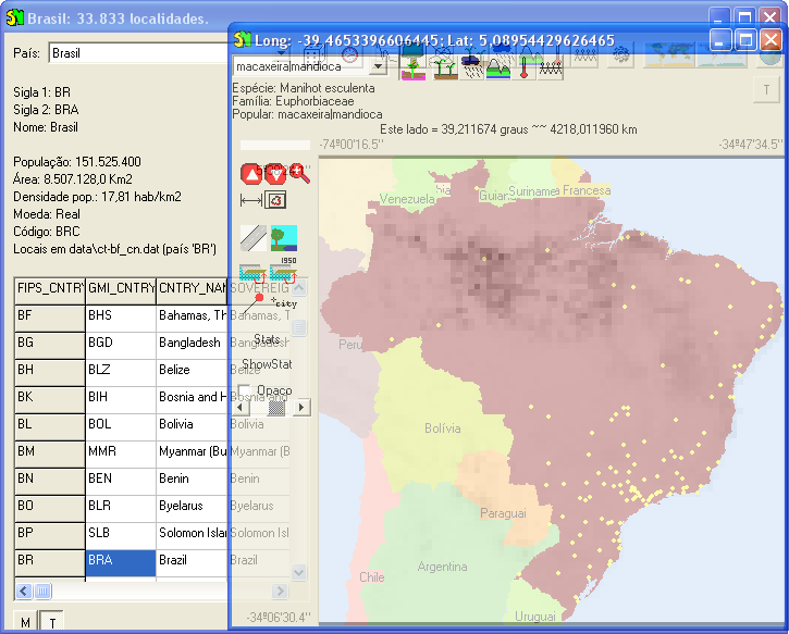
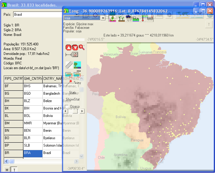
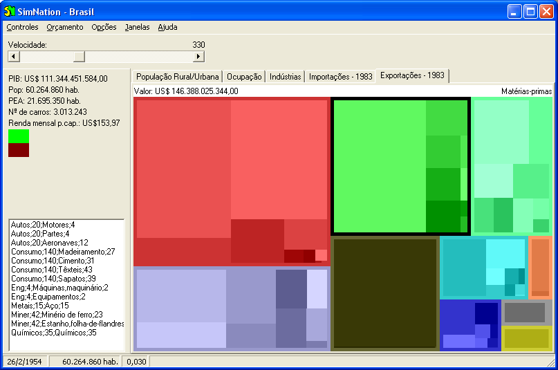
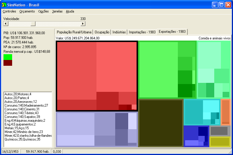
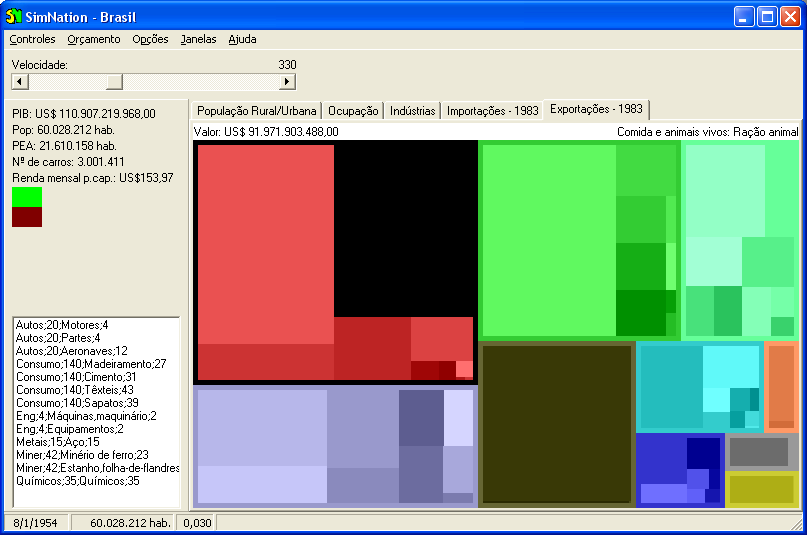
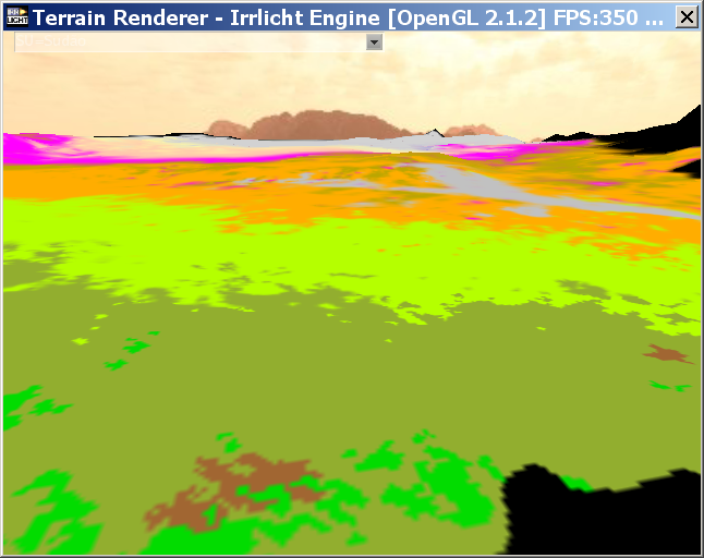
All the data is available from "official" sites (such as UN, CIA, national statistical services, etc). A first draft, with some of the data already in use, is available here at sourceforge as SimNation (version 0.3, with Delphi source). Now I've changed to C++ and 3D (thanks to Irrlicht team!). Some screenshots:
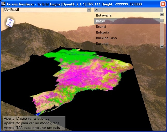
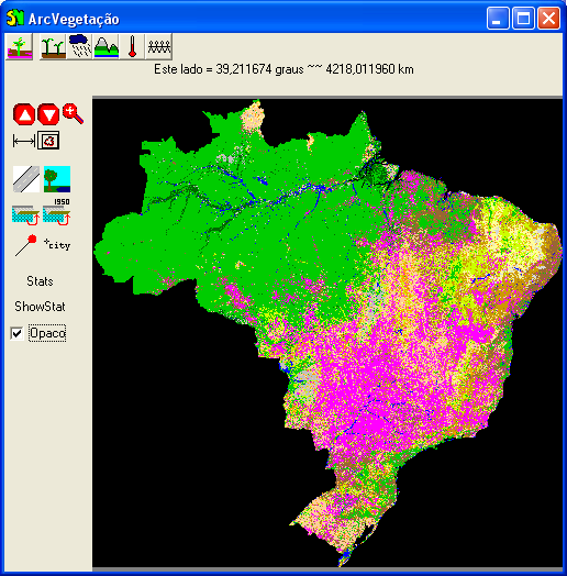
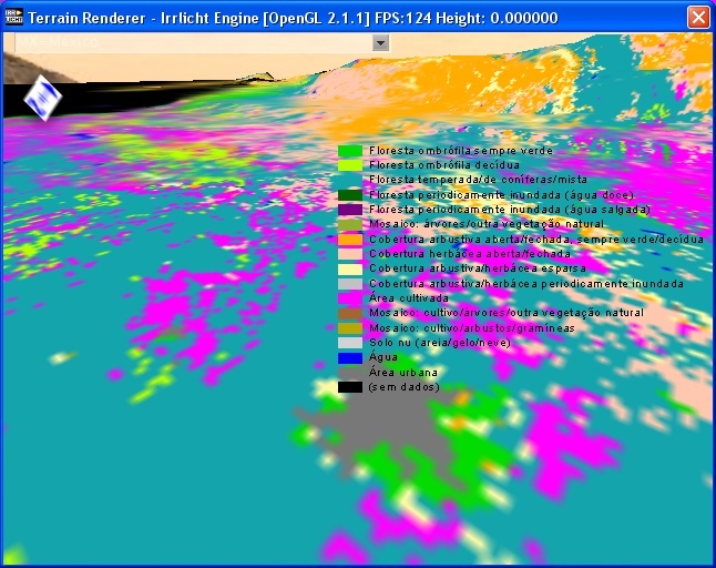
Brazil - general view showing degradation of central savannas (Cerrado) and the arc of deforestation surrounding Amazonia.
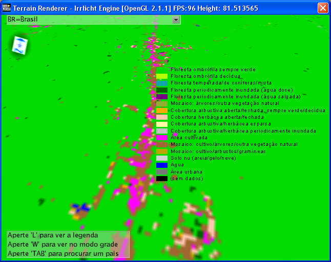
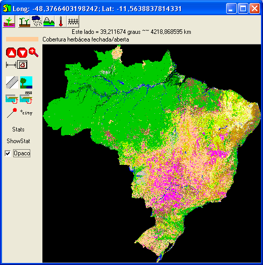
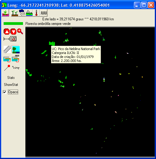
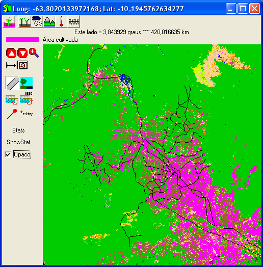
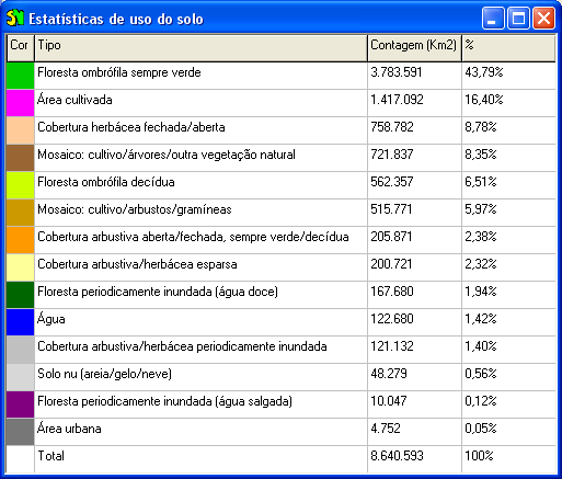
Brazil - showing the vegetation classes and deforestation along a "transamazon" road.
Ciudad de Mexico and some mountains at North.
Congo forests.
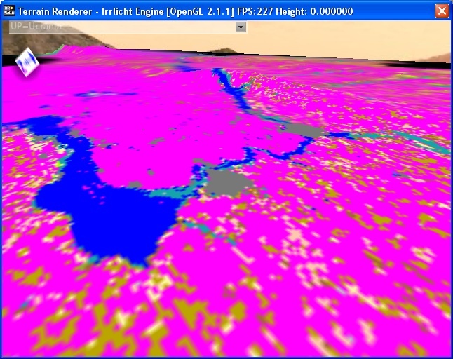
Ukraine - showing predominance of cultivated areas (other maps show what is being cultivated in each area)

China - showing a great variety of environments
Sudan. Saara at North, Ethiopia mountains at East.
That's it! Hope to hear from you who would love to change the world!